Paddling Rocky Gorge Reservoir
Update for 2016
Just like Triadelphia Reservoir, Rocky Gorge Reservoir requires a permit to use. Check out the Triadelphia Reservoir web page for this information. The cost for a day use permit is $6, and a yearly permit runs $70. These permits can be purchased at the Brighton Dam Visitors Information Center. Fortunately, there is an app the that allows purchase without making a trip to Triadelphia reservoir.
Another great update from the WSSC is the new map of the reservoir. Maps were available at the Visitors Center, but now they are available online. Here is a link to the WSSC map of the Rocky Gorge Reservoir.
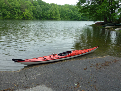
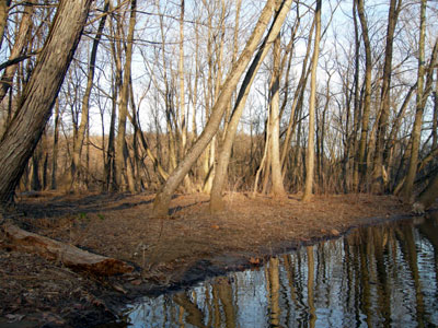
At the end of the 2016 season, I launched from both Scott's Cove and Supplee Landing. The water level is below a bit lower than during the summer. The end of the boat launches do not reach the shoreline, so water access is more difficult.
Update for 2011
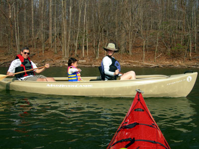
Wow, it has been quite a while since I have been kayaking. From my pages here, it looks like a couple of years, but I am back in the boat this season with another trip on the Rocky Gorge Reservoir. I picked up my permit and found quite an increase in the prices from my prior season (2009). Yearly passes now run $60 with day passes at $5. The paddling in this area is still great. After arriving at Scott's Cove, I see that the water level is quite a bit a higher than the last time. I put my boat in the water and take off up the reservoir.
Before reaching the second mile of the trip, I saw a small heron swimming in the water. All I could see was the head and neck like the Loch Ness Monster. This heron ducked underwater and swam quite a distance before coming to the surface. It must have covered fifty feet underwater.
I am always amazed that I am paddling within a few miles of major highway and I see and hear none of the signs of modern civilization. I round a corner and can see and hear Route 29. I cross under the Route 29 bridge and see many birds flying between the bridge piers. For the rest of the trip, I saw very few birds making this quite a noteworthy feature.
Continuing beyond the bridge, the sounds of Route 29 disappear after another half mile, and I am returned to the quite, peacefulness of the reservoir. The threat of rain is high on this trip and the wind has started to pick up. The surface of the water is generally smooth with no whitecaps or other significant waves. I decide to head back and not risk getting caught in the rain. With the water this high it is difficult to find a spot to land and put on additional gear.
I reach the bridge and the 2.25 mile mark back to the launch site. Since virtually no construction is visible from the reservoir, you have to make sure that you know the way back and not wander down one of the many inlets. Fortunately, the moored boats around Scott's Cove make the last section pretty easy to see.
Update for 2008
Just like Triadelphia Reservoir, Rocky Gorge Reservoir requires a permit to use. Check out the Triadelphia Reservoir web page for this information. Fortunately, the cost for both the yearly permit ($30) and the single day use permits ($3) have not changed from previous years. The Brown's Bridge landing will remain closed this year even though the Washington Suburban Sanitary Commission (WSSC) webpage does not mention this. The ranger at Brighton Dam mentioned that kayak launching will still be allowed, but it will require carrying your kayak over or under the rope. The rangers at the WSSC Visitors' Center can be contacted at 301-774-9124 to address any questions on this. I have not recently launched from this area and currently the water level appears quite low.
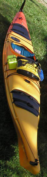
For the first time, I have tried launching from Scott's Cove. The parking area is gravel and access to the boat ramp is down a narrow paved road. There is a single chemical toilet available. The WSSC rents boat storage spots in this area and many canoes, kayaks, and fishing boats are locked to their assigned locations.
Katie and I paddled 10.25 miles and turned around just before we reached the Brown's Bridge launch site. Since electric fishing boats have limited range, we did not see many of these boats after we paddled about half an hour. This made the trip feel more isolated and peaceful than our proximity to both Baltimore and Washington would suggest. Aside from crossing under Route 29 and seeing the occasional aircraft, the sounds of the highway and cities were eliminated.
We saw several birds of prey over the water. It is amazing how fast they can climb using just the thermals and wind currents. With the trees just starting to show their new leaves, the birds must have had a good view over the forest, but we did not see them go for any critters or fish. Katie and I also spotted several heron along the way.
We both enjoyed our first paddling trip of the 2008 season and we look forward to many other great trips this year. The Rocky Gorge Reservoir is a great place to paddle and I look forward to many other trips to this area.
Paddling Notes from 2007
With the cold start to the 2007 paddling season, I have not had a chance to take my kayak out on the water. I have been looking forward to getting started, and I usually kick off the season with a couple trips to the Triadelphia Reservoir and the Rocky Gorge Reservoir. When I picked up my water use permit, I heard that the Brown's Bridge access point will be closed for the 2007 paddling and boating season. Fortunately, when I confirmed this information in the middle of April, kayak launching from this location will be permitted, but you have to carry your kayak and equipment over (or under) the rope blocking vehicular access. The rangers at the Washington Suburban Sanitary Commission (WSSC) Visitors' Center can be contacted at 301-774-9124. The boat access information does not currently appear on the WSSC webpage.
Both the Triadelphia Reservoir and the Rocky Gorge Reservoir appear to have plenty of water and the season has started, so as soon as the weather warms up a little, I will get my kayak out on the water.
Paddling Notes from 2006
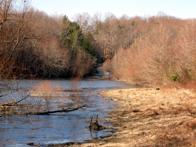
With the maintenance on the Brighton Dam and the low water in the Triadelphia Reservoir, the water level in the Rocky Gorge Reservoir changes quickly based on water use and rain levels. I have two pictures showing the water level before and after the multi day rain at the end of June 2006 that led to flooding in Laurel and other areas. The first picture was taken on Saturday during the first day of rain and the second picture was taken after the sluice gates on the T. Howard Duckett Dam were closed. According to the article in the Baltimore Sun, the Rocky Gorge Reservoir went from low water level to 100% and officials had a tough time determining the right time to open the gates.
The WSSC, who controls the T. Howard Duckett Dam and the Brighton Dam, also reported the need to release water and has continued to release water to allow for the additional rain received in early July. The Rocky Gorge Reservoir holds 5.7 billion gallons of water when it is filled and with the Triadelphia Reservoir a total of 12 billion gallons of water can be stored. Since maintenance is being performed on the Brighton Dam, the water that normally drains into the Triadelphia Reservoir continued into the Rocky Gorge Reservoir.
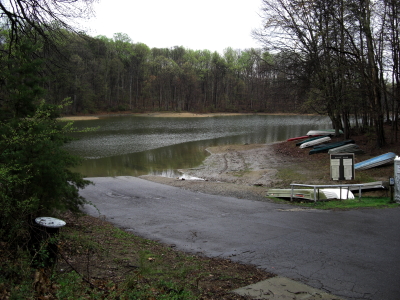
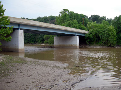
Just like Triadelphia Reservoir, Rocky Gorge Reservoir requires a permit to use. Check out the Triadelphia Reservoir web page for this information. After picking up your permit from the WSSC Visitors' Center, head to the Brown's Bridge launch site by turning right after leaving the parking lot. Make your sixth right on Highland Road. Highland Road turns into MD216 at a traffic light where MD108 crosses. Turn right at the traffic light on Brown's Bridge Road. Cross the bridge and the access to the boat launch is on the left hand side located at GPS coordinates (N 39° 8.730' W 76° 57.790'). A map to this point is available using this link to Google Maps. Additional parking is available across the street from the access to the boat launch. The parking lot before the bridge, located at GPS coordinates (N 39° 8.794' W 76° 57.623') is not a good place to launch from. From the base of this parking lot, the boat launch site can be seen across the water as shown in the first picture.
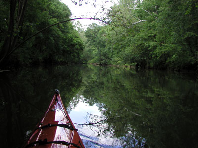
Leaving the boat ramp and going under the bridge, the water way becomes narrower than the more open reservoir. This route does not become tight for kayaks for quite some distance. In my 17-foot kayak, I have no trouble paddling around the shallow areas and occasional fallen trees to Snell's Bridge (about two miles). Even though Rocky Gorge Reservoir is between Baltimore and Washington, a sense of tranquil remoteness envelops this area. The sound of nature is clear throughout most of this region reminding me more of the distant Chesapeake Bay. The additional tree cover overhead makes lots of great shade, so this trip is great during the hot summer months.
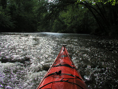
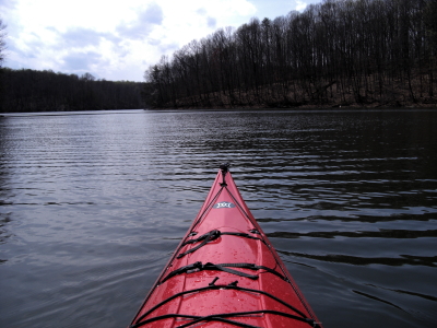
The current in the stream is usually minimal since the Brighton Dam controls it, but after leaving Snell's Bridge, the current is more noticeable. The current makes for an easy return trip, but kayaks are generally not good going upstream through rapids. Here is the farthest point I was able to reach on this trip approximately three quarters of a mile beyond Snell's Bridge.
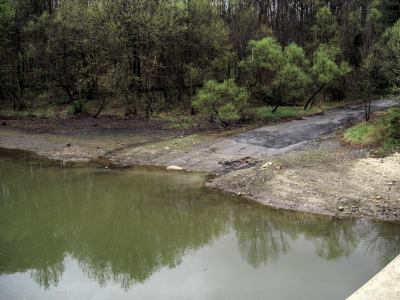
It is a little tricky to turn around in the shallow rapids where this picutre was taken. Be sure to remember that once the kayak is perpendicular to the current, there is a tendancy for the kayak to roll over.
The Rocky Gorge Reservoir has many great things for the paddler to see. In the spring, the wild Mountain Laurel is in bloom and is visible along the banks particularly on the left side when traveling upstream. Sightings of Bald Eagles and other birds of prey are common, so look in the higher branches of dead trees. Birds of prey often take their fresh catch to the higher branches of dead trees, so they can eat their fish and make sure there is no way to sneak up on them.
Earlier this year, on my way downstream from this point, I heard the Spring Peepers loud and clear marking the beginning of the 2006 paddling season. The Spring Peeper is a tiny frog not longer than an inch. It often has an 'X' or part of an 'X' on its back. It is very hard to find these little frogs, but their sound is easy to identify. This region of the Rocky Gorge Reservoir has a large number of active peepers. By running the sound file here, you can hear the sound of the peepers.
The water in Rocky Gorge Reservoir is extremely cold early in the season, so appropriate gear and preparation is essential. As I paddle under Snell's Bridge, the sound of the peepers disappears. The conditions for the peepers must still be a little on the cold side.
The view from the water today is quite different than the view in the summer. The signs of spring are clear from the start of the new growth. This is a great start to the 2006 paddling season, and I am looking forward to a number of great paddling trips in the near future. In a few weeks, the water temperature will rise and more paddlers will be out on the water.
Continuing downstream, I pass under the Brown's Bridge and return to the boat launch on the right hand side. On another warm Friday afternoon, I meet up with my good buddy Bruce, and we continue this trip downstream into main reservoir. With Bruce, Katie, and Jessie in the canoe, we paddle around the bend and immediately spot a Canadian goose on a nest. The nest is hidden on the rocks just above the water. At several places along the shoreline there are signs of nests under construction.
As we paddle along the reservoir, we see many geese, horses on a trail, and several groups of deer. It is amazing that this amount of wildlife exists so close to major metropolitan areas. The sense of remoteness surrounds us and makes for a pleasant paddling trip.
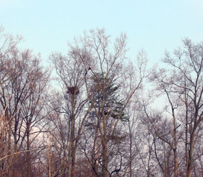
Near the point where we turn around, we see a bald eagle circling in the sky. After checking out the local sushi market, the eagle lands in a nearby tree. The nest in the tree shown in the picture may belong to the eagle.
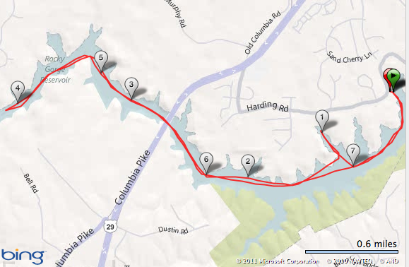
Turning around, we head back to the launch site. We have a slight wind at our backs and reach the launch site without difficulty. The reservoir is deeper in this section, and we do not notice any current. Our round trip distance was 5.7 miles.
On previous paddling trips, I have started from Supplee landing near the dam for the Rocky Gorge Reservoir. To reach the same turn around point described, I paddled 9.3 miles round trip making the round trip distance between these landings 15 miles. The paddling around Brown's Bridge is the nicest part of the Rocky Gorge Reservoir.