Paddling the Chesapeake: Tred Avon River
The cold water requires the use of extra cold water gear. This week Katie and I got some Henderson wetsuits. I have the hyper-stretch wetsuit that allows for free range of motion with less restriction from the wetsuit. With this and a spray skirt, we stayed warm enough during our paddle. If we flipped over and required a wet exit, drying off on the shore and changing into dry clothes would have been necessary. Even though it was fairly chilly, this is Katie's favorite time of year to paddle. Early in the season, there are few other boats even in areas that are usually crowded and filled with powerboats and jet skis. For our first trip on the Chesapeake Bay in 2006, we had overcast conditions turning into partly sunny with little to no wind.
The put in site is located at GPS coordinates of (N 38° 41.686' W 076° 10.153'). A map to this location opening in a new window is available from Google Maps by clicking here.
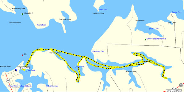
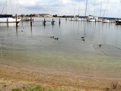
We started our trip by heading across the marina to the shore on the far side (as shown by the GPS map from my Garmin GPS). With no boat traffic this crossing was trivial, but later in the summer watching for traffic will be important. During our entire day, we saw only the ferryboat, a fishing boat, and one powerboat.
Once we reached the far shore, we followed the shoreline into a small inlet. In the center of this inlet is a sand bar that we could pass over without hitting bottom. It was high tide, so this may be a good rest stop at low tide. We found a swan's nest off to the side. Katie and I kept our distance to avoid needlessly irritating the swan.
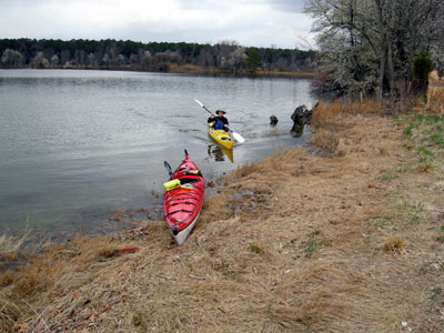
We continued to paddle following the shore and noticing the new construction on the waterfront. After a short way, the shore was mostly covered with native grass and trees with farmland slightly further from shore. We found an area where the fields reached the water and took a break for lunch. Getting out of the kayaks for lunch made for a good rest stop, and walking around to stretch our legs felt good. The spray skirt prevents air circulation between the inside of the kayak and the surrounding air. In the summer this can be irritating, but in the cooler weather, we found it to be comfortable. When we got out for lunch, we both felt the increased cooling from the air, so we got back in the kayaks and resumed paddling. In a few minutes, we were toasty warm again and the sun was coming out.
After we got back to the launch site, we had paddled 8.25 miles and had a great day. We finished our day with a dinner at The Crab Claw in St. Michael's. The scenic ferryboat is a short crossing from Oxford to St. Michael's. The price for the ferry was $8 for car and driver plus $1 per passenger. Different rates for pedestrians, bikes, and motor cycles were also posted.
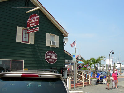
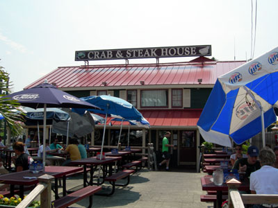
I had a chance to go back here over the July fourth holiday. The water was warmer and there were more boats. I found a restaurant that I liked much better this time. St. Michaels Crab and Steak House is located at the end of Mulberry Street in St. Michaels, and I have included pictures from the end of Mulberry Street and outside seating below.